
Nebraska Street Directory by Address
For a Nebraska address, follow the same parcel through each record. No single result establishes who is inside a building today.
- Choose the county. Use the Nebraska Department of Revenue directory to find its assessor, parcel, and GIS links. Follow the parcel's county, not only the mailing city.
- Save the assessor result. Search by address, owner name, or account number if offered by the Nebraska county assessor. Record the owner, situs and mailing addresses, Nebraska parcel ID, legal description, and source date.
- Match the map. Select the same parcel in Nebraska county GIS and compare its ID and legal description. The map is not a certified title record.
- Open the deed index. Search the owner as grantee in the Nebraska county index with the legal description or instrument number. Confirm the instrument before following the grantor backward.
- Check the other record types. Nebraska VoterView checks one named registrant; a library reverse directory may show an earlier address listing for a published year.
This is a property trail, not a census of households. Its reach depends on county coverage, public-record limits, and directory years.
Which Nebraska Assessor Routes Support Address Search?
Nebraska has 93 counties and no uniform assessor form. The Nebraska Department of Revenue's county directory lists local offices, portals, and GIS links. Adams County, Nebraska's verified hub offers Real Estate Search, account, name, address, sale, building, sketch, photo, property-card, and GIS routes.
The table reflects those visible fields; other counties differ.
| Search route | What to enter or open | What it can return | Scope note |
|---|---|---|---|
| Nebraska county account or parcel number | County account identifier | Nebraska parcel card and linked property data | Identifier format belongs to the county; leading zeros may matter in state tools. |
| Nebraska owner name | Person or entity name | Owner-linked county parcel results | Exact and partial matching depend on the vendor; verify the parcel before treating a match as the same owner. |
| Nebraska street address | Situs or property address | Physical parcel and account record | Normalize the number and street suffix; rural Nebraska legal descriptions may not use a street address. |
| Nebraska sale search | Open the separate sale mode | Published sale or transfer fields | Search controls and sale details vary by county; confirm a transfer in the deed index. |
| Nebraska building, sketch, photo, or card | Select the named building or record route | Improvement details and a property record card where supplied | Available routes depend on county publication and record type. |
| Nebraska GIS mapping | Open the county map or parcel layer | Parcel geometry, map layers, and linked parcel identifiers | Layer names and tools vary; do not assume a ZIP search is available. |
Adams provides data “as is”; equalization and exemptions can change taxable values. Treat cards as dated snapshots. If a portal is thin, contact the county assessor or request the parcel record in writing.
The Adams County assessor search page shows the name, address, account, sale, building, property-card, and GIS routes described above.
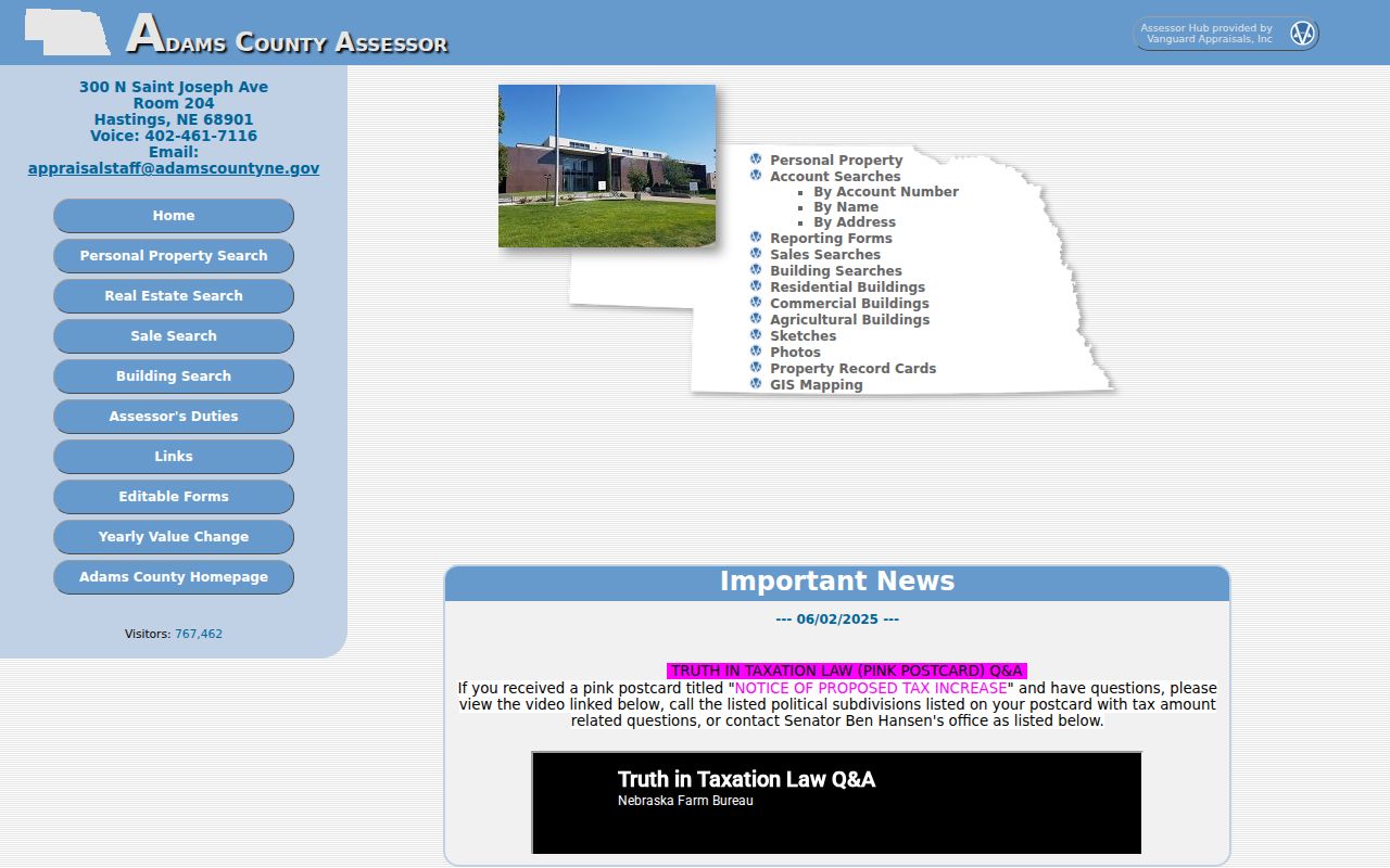
That county interface illustrates the range of parcel lookup choices; the property fields and names shown in another Nebraska county may differ.
Nebraska Street Addresses: Situs and Mailing
In Nebraska assessor records, situs is the parcel's physical location; the mailing address receives property-tax notices. A mismatch may point to an off-site owner, entity office, representative, or tax service. It neither establishes the owner's home nor identifies unnamed occupants.
Retain both labels, Nebraska county, and record date. Nebraska deed, tax, voter, and directory entries describe different address relationships; do not turn “mailing” into “residence.”
Note: Parcel ownership does not prove the owner was present.
Nebraska Parcel and Plat from an Address
Nebraska land records are indexed by parcel ID or legal description, not always street number. A city description may name lot, block, and plat; rural Nebraska records may use section-township-range or metes-and-bounds. Use the legal description when an address is missing or shared, and expect Nebraska county account formats to vary.
- Parcel
- Nebraska land tracked by a county identifier; one address can cover multiple parcels or one parcel contain multiple structures.
- Situs address
- The Nebraska property location assigned to the parcel, distinct from the tax-mailing address.
- Plat
- A Nebraska recorded map laying out lots, blocks, streets, and subdivision names used in legal descriptions.
- Criss-cross directory
- A historical Nebraska directory section arranged by street and number, so a researcher can begin with an address and locate a name entry.
If numbers do not line up, compare the legal description with the plat and map; preserve old wording even when a modern address seems to match.
Nebraska Deed Index by Parcel
Nebraska county deed sites have different cutoffs and controls. The Nebraska Deeds Online landing page does not expose one field list for every county. Platte County, Nebraska reports online data and images from February 1, 2005; Lincoln County, Nebraska uses instrument numbers after March 2000 and book/page references earlier. Lincoln's Nebraska office describes computer-generated grantor/grantee indexes and genealogy search. Knox County, Nebraska says recorded documents date from the 1850s, but online access may cover less.
Search the owner as grantee with the parcel's legal description. Record the parties, document type, dates, instrument or book/page, and legal description. Read the instrument before calling it a sale: a mortgage, release, lien, or plat is different.
The Nebraska Deeds Online entry screen shows the grantor/grantee and legal-description starting points for a county deed search.
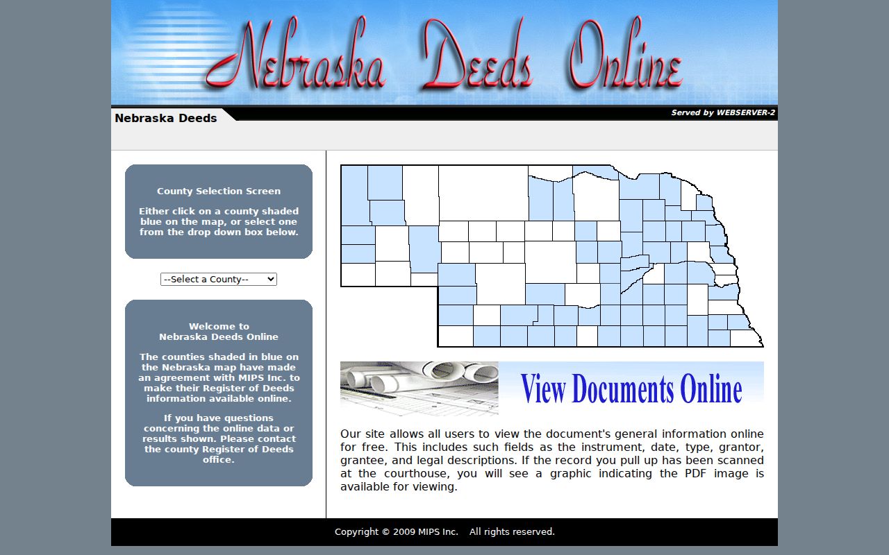
When a Nebraska web index ends, ask the county Register of Deeds about counter access, archived books, microfilm, FamilySearch, or a copy request. Certified copies and fees follow local rules.
Note: Treat a deed chain as a history of interests in a parcel; it does not by itself describe every household that used the building.
Nebraska Address Record Coverage
Offices join records by address, parcel, legal description, or named person. This directory tracks those keys and source limits; it is not a resident roster.
| Record set | Address key | What it can answer | Access and limit |
|---|---|---|---|
| Nebraska assessor/CAMA parcel | Situs, account, or parcel | Recorded owner, tax-mailing address, value, exemptions, building data | Nebraska county portal, counter, or written request; owner is not necessarily occupant. |
| Nebraska GIS parcel viewer | Parcel polygon, street, or coordinates | Which Nebraska parcels meet a street segment and which map districts apply | Public Nebraska county map or ArcGIS service; map is not certified title. |
| Nebraska Register of Deeds index | Legal description, parties, instrument, book/page | Recorded transfers, mortgages, liens, releases, and plats | Nebraska county web index, counter, books, or microfilm; online coverage and images vary. |
| Nebraska VoterView and voter register | Named registrant plus county | Registration entry, address, precinct, party, and status | Free named-person search; inspection, copying, distribution, and use have statutory limits. |
| Nebraska permit or code case | Address, parcel, or permit number | Work, inspections, applicants, contractors, and dates where retained | Local Nebraska city portal or written request; retention and public fields vary. |
| Nebraska reverse/criss-cross directory | Street name and number | Historical address listing, name, and sometimes occupation | Print, microfilm, or digitized Nebraska years; gaps and abbreviations need checking. |
| Nebraska plat or Sanborn map | Lot/block, street, or mapped building | Subdivision, footprint, use, materials, and street context | Library, archive, or map collection; it does not name a current occupant. |
For a state-level orientation, start with the Nebraska Department of Revenue's county office list. It connects an address to local assessor, treasurer, clerk, and Register of Deeds routes. The owner's name and a street address are different record keys.
Browse GIS Layers Along a Nebraska Street
Search a Nebraska street address in county GIS, select the parcel, copy its account and legal description, then verify in the Nebraska assessor or deed index. Pan or select adjacent polygons; use measure or buffer controls where offered.
The Lancaster/Lincoln, Nebraska GIS viewer documents parcels, subdivisions, zoning before and after 1979, historic sites, school and tax districts, rural water, flood and growth areas, annexations, and neighborhood or homeowner-association layers. The Lincoln, Nebraska neighborhood layer exposes NAME, ACTIVE, Acres, Overlay, ID, and geometry fields. These local examples are not features promised by every Nebraska county viewer.
Layers describe place, not occupants. Save the layer name and parcel key so the result can be checked again.
Check a Named Nebraska Street Voter
Nebraska VoterView's registrant form requires First Name, Last Name, and County; separate fields find a polling place or check a pending change. A result may show a Nebraska address, party, ballot status, and polling place, never ballot choice.
Nebraska voter registers may be inspected at the election office, but copying is limited. The $500 Nebraska statewide file requires an affidavit, approved use, and may be refreshed monthly for a year. Do not publish it or turn a named check into a block roster; contact the county election custodian.
Note: A registered voter can be temporarily away, while a Nebraska resident may not be registered; neither result settles daily occupancy.
Nebraska Address Permits and Building History
Permits may attach work, inspections, applicants, contractors, and dates to an address, but older files may be missing and applicants may not own or occupy the parcel. Request records from the local building office; Nebraska has no statewide city-permit search.
Lincoln, Nebraska's public occupancy search covers May 1, 1999 through January 18, 2013; newer permits use Accela. Omaha Public Library in Nebraska reports a former inspector discarded a large run of old building records, so a gap does not prove no work occurred. If a Nebraska city has no portal, ask its building department about counter access or a written request under the Nebraska Public Records Statutes.
Old Nebraska Street Criss-Cross Volumes
Omaha Public Library in Nebraska reports print directories from 1866 to current and microfilm through 2001, with runs for Lincoln, Nebraska and other towns. These Nebraska reverse sections start with street and number; check the edition key before interpreting an abbreviation.
For years and access details, the Nebraska city directory guide covers those collections. Record the year, street spelling, number, page, and volume title, then compare with a deed, census, newspaper, or map. A gap does not prove a household was absent.
Nebraska libraries, History Nebraska, and county societies provide print, microfilm, finding aids, scans, or courthouse references when a web search ends. The FamilySearch Nebraska wills and deeds collection is another county- and year-dependent index/image route. A scan or finding aid is a lead, not a certified copy.
Nebraska ZIPs and Street Jurisdiction
A ZIP code is postal geography, not a city limit, county, parcel, or courthouse jurisdiction. USPS says ZIP Codes do not always follow municipal boundaries, and the Census Bureau's ZCTAs are statistical approximations, not exact delivery areas.
In Omaha, Nebraska, the 681xx family covers neighborhood, business, and delivery areas; Offutt Air Force Base in Nebraska uses 68113. Check an exact address in the USPS ZIP+4 lookup, then use the parcel to identify its Nebraska county. Postal city and local jurisdiction can differ.
Military Avenue and 144th Street cross older mapped geography. Annexations and street changes can split modern addresses from old deeds; compare plats and Sanborn maps.
Privacy Boundaries for a Nebraska Street Directory
Nebraska assessor and deed records describe land interests, not every occupant. Nebraska VoterView is a named check and protected voters may be withheld; DMV addresses, utility customer lists, and sealed or juvenile files are not general resident records. Permit applicants, tax contacts, and directory entries do not prove presence.
Public records are available for lawful, personal research, but assembling or publishing address details can affect real people. Nebraska's stalking and harassment laws address a knowing course of conduct aimed at a person without a legitimate purpose; state safety guidance notes that public records can be misused to locate someone. Keep only details needed for a family-history, property, or civic question, and verify before drawing a conclusion.
Lawful use. Use a Nebraska street directory for a specific, lawful personal question. Do not use public address records to stalk, threaten, harass, or expose a protected person's location.